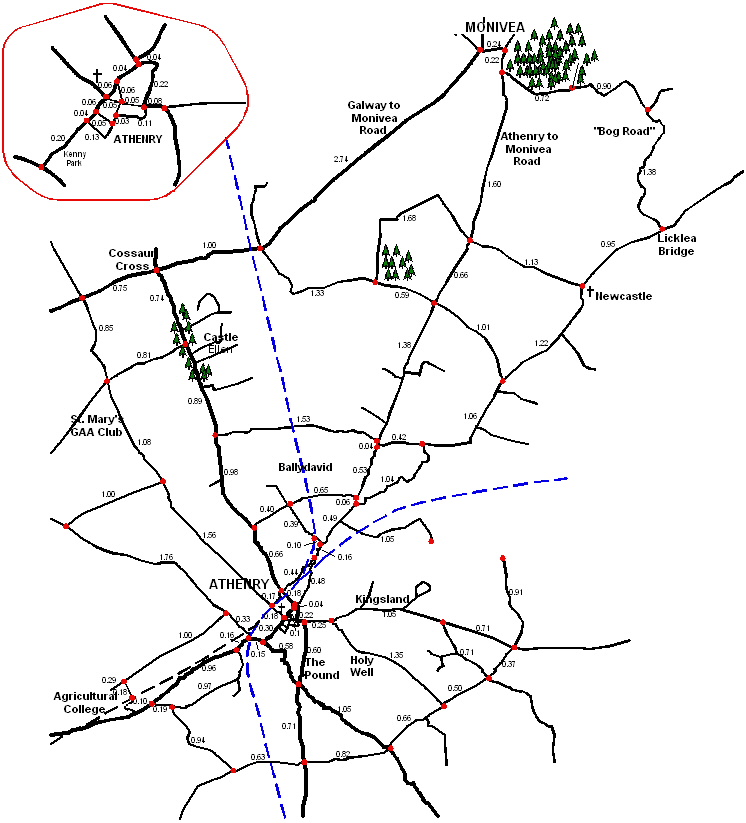
Attached is a map of Athenry with distances marked out. I've inserted the distance between all junctions so that you can use it to work out the length of a route before or after a run. I use it all the time and I know that many others have a copy for some time now. If you find it useful, print it out and laminate it.
All distances are in miles. All distances were worked out by scanning an ordnance survey map and using a piece of software called Accuroute to measure the distances. I find it's pretty accurate, but if you use it enough you're sure to find a few mistakes.
Document